Please use this identifier to cite or link to this item:
https://hdl.handle.net/11681/7557Full metadata record
| DC Field | Value | Language |
|---|---|---|
| dc.contributor.author | Lynch, Gary C. | - |
| dc.contributor.author | Sánchez, José A., 1963- | - |
| dc.date.accessioned | 2016-05-06T14:33:19Z | - |
| dc.date.available | 2016-05-06T14:33:19Z | - |
| dc.date.issued | 2001-09 | - |
| dc.identifier.uri | http://hdl.handle.net/11681/7557 | - |
| dc.description | Technical report | - |
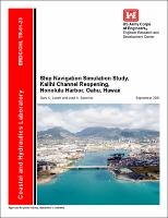
| dc.description | Honolulu Harbor, located on the southern side of Oahu, Hawaii has one entrance, the main channel entrance. Because of the closure of the lift on the Sand Island Bridge and the addition of a second, nonlift bridge, Kalihi Channel no longer opens into Honolulu harbor. A tunnel has been proposed to replace the Sand Island Bridge, and, with the destruction of the old bridge, the possibility for ships and tows/barges to transit Kalihi Channel as well as the main Honolulu Channel would exist once again. Although the harbor operated with these two channels before the closure of the first bridge, changes in vessel dimensions since the closure and the proposed deepening of Kalihi Channel (to make it the same depth as the rest of the harbor made a navigation study necessary to evaluate the efficiency and safety of the project. | - |
| dc.publisher | Coastal and Hydraulics Laboratory (U.S.) | - |
| dc.publisher | Engineer Research and Development Center (U.S.) | - |
| dc.relation | http://acwc.sdp.sirsi.net/client/en_US/search/asset/1000662 | - |
| dc.relation.ispartofseries | ERDC/CHL TR ; 01-23. | - |
| dc.rights | Approved for public release; distribution is unlimited. | - |
| dc.source | This Digital Resource was created from scans of the Print Resource | - |
| dc.subject | Bridge | - |
| dc.subject | Deep-draft ships | - |
| dc.subject | Harbor | - |
| dc.subject | Hawaii | - |
| dc.subject | Honolulu HArbor | - |
| dc.subject | Navigation | - |
| dc.subject | Simulation | - |
| dc.title | Ship navigation simulation study, Kalihi Channel reopening, Honolulu Harbor, Oahu, Hawaii | - |
| dc.type | Report | en_US |
| Appears in Collections: | Technical Report | |
Files in This Item:
| File | Description | Size | Format | |
|---|---|---|---|---|
| CHL-TR-01-23.pdf | 12.07 MB | Adobe PDF |  View/Open |