Please use this identifier to cite or link to this item:
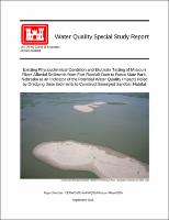
https://hdl.handle.net/11681/48298| Title: | Water Quality Special Report : Existing Physicochemical Condition and Elutriate Testing of Missouri River Alluvial Sediments from Fort Randall Dam to Ponca, Nebraska as an Indicator of the Potential Water Quality Impacts Posed by Dredging These Sediments to Construct Emergent Sandbar Habitat |
| Authors: | United States. Army. Corps of Engineers. Omaha District |
| Keywords: | Missouri River Sand bars River sediments--Testing Water quality--Testing Aquatic habitats Stream restoration Environmental management Environmental protection |
| Publisher: | United States. Army. Corps of Engineers. Omaha District. |
| Abstract: | In 2000, the U.S. Fish and Wildlife Service (USFWS) issued a Biological Opinion with recommendations for the U.S. Army Corps of Engineers’ (Corps) operations of the Missouri River Mainstem System for protection and enhancement of threatened and endangered species (USFWS, 2000). In 2003, the USFWS issued an amendment that supplemented the recommendations of the 2000 Biological Opinion (USFWS, 2003). The amended Biological Opinion (BiOp) was the result of continuing consultation between the Corps and USFWS under the Endangered Species Act (ESA). The BiOp found that the Corps' operations on the Missouri River were not likely to jeopardize the endangered interior least tern (Sterna antillarum) and threatened piping plover (Charadrius melodus) populations if the Reasonable and Prudent Alternative (RPA) set forth in the BiOp was implemented. Element IVB of the RPA includes recommendations for the mechanical creation and maintenance of Emergent Sandbar Habitat (ESH) as nesting habitat for these two species in terms of habitat acres per river mile. The BiOp separates the Missouri River from Fort Randall Dam downstream to Ponca, Nebraska into three separate segments: 1) Segment 8 – Fort Randall Dam to Niobrara River; 2) Segment 9 – Niobrara River to Gavins Point Dam; and 3) Segment 10 – Gavins Point Dam to Ponca, NE (Figure 1). All three segments are identified as “High Priority” reaches for the interior least tern and piping plover. ESH goals of 10 acres per river mile by the year 2005 and 20 acres per river mile by the year 2015 have been established for Segment 8. ESH goals of 40 acres per river mile by the year 2005 and 80 acres per river mile by the year 2015 have been established for Segments 9 and 10. Existing ESH acreages within these segments are currently below these goals. In accordance with the BiOp, the Corps is conducting ongoing efforts to create and/or reclaim a sufficient amount of ESH to stabilize, and eventually recover, interior least tern and piping plover populations along the Missouri River. The creation of ESH was necessitated by the unforeseen loss of the habitat due to channelization and flood control efforts along the Missouri River, and the resulting decline of tern and plover numbers. The specific purpose for the Corps' actions is to implement the portion of RPA Element IVB of the BiOp that relates to artificially or mechanically created ESH. The importance of constructed ESH in the lower Missouri River to the least tern and piping plover populations was witnessed with the recent return of normal navigation flows to the Missouri River downstream of Gavins Point Dam. ESH projects constructed downstream of Gavins Point Dam produced 80 percent of the interior least terns and piping plovers that fledged on the lower Missouri River with over 100 successful nests documented. In 1997, the last time high water and flows occurred prior to recent drought conditions, only one successful nest was documented in the reach. |
| Description: | Technical Report |
| Rights: | Approved for Public Release; Distribution is Unlimited |
| URI: | https://hdl.handle.net/11681/48298 |
| Appears in Collections: | Technical Reports |
Files in This Item:
| File | Description | Size | Format | |
|---|---|---|---|---|
| Water Quality Special Study Report - Testing of Sediments from Fort Randall Dam to Ponco State Park_2010.pdf | 44.96 MB | Adobe PDF |  View/Open |