Please use this identifier to cite or link to this item:
https://hdl.handle.net/11681/4994Full metadata record
| DC Field | Value | Language |
|---|---|---|
| dc.contributor | Coastal Inlets Research Program (U.S.) | - |
| dc.contributor | United States. Army. Corps of Engineers. Mobile District | - |
| dc.contributor | Regional Sediment Management (RSM) Demonstration Program (U.S.) | - |
| dc.contributor.author | Lillycrop, Linda S. | - |
| dc.contributor.author | Wozencraft, Jennifer M. | - |
| dc.contributor.author | Hardegree, Lynn | - |
| dc.contributor.author | Dopsovic, Rose | - |
| dc.contributor.author | Lillycrop, W. Jeff | - |
| dc.date.accessioned | 2016-03-18T14:21:59Z | - |
| dc.date.available | 2016-03-18T14:21:59Z | - |
| dc.date.issued | 2004-05 | - |
| dc.identifier.uri | http://hdl.handle.net/11681/4994 | - |
| dc.description | Coastal and Hydraulics Engineering Technical Note | - |
| dc.description | Purpose: The goal of the US Army Corps of Engineers Mobile Districts (CESAM) Regional Sediment Management (RSM) technical program was to develop and apply tools to allow CESAM to evaluate coastal processes, quantify sediment transport, and understand sediment transport patterns and pathways at regional scales as well as at project scales. A lesson learned is that successful implementation of RSM requires application of engineering tools appropriate for regional management and analysis. Regional engineering tools include the sediment budget, numerical models, and a Geographic Information System (GIS). Each tool requires contemporary and historical data sets for input and analysis. Ideally, continuous synoptic surveys are available on a regional scale. The sediment budget is the primary tool for regional management because it provides an understanding of the sediment transport patterns and pathways, and beach and bathymetry changes over the region. Through the sediment budget, regional impacts resulting from proposed project modifications can be predicted. Development of the regional sediment budget is directly linked to data management and analysis within the GIS, and sediment transport rates derived from numerical modeling. Because data collection and numerical model applications are historically obtained and applied on a project-by-project basis, difficulties can be encountered in developing a regional sediment budget. This Coastal and Hydraulics Engineering Technical Note (CHETN) documents the lessons learned from the RSM technical program implementation by the US Army Corps of Engineers Mobile District, Mobile, AL. The CESAM RSM demonstration region extends approximately 600 km from the St. Marks River, FL (eastern boundary), to the Pearl River, MS (western boundary) (Figure 1). To aid in the management of such a large region, the domain was divided into 11 sub-regions based on geography, geology, and/or sediment transport patterns. | - |
| dc.publisher | Coastal and Hydraulics Laboratory (U.S.) | - |
| dc.publisher | Engineer Research and Development Center (U.S.) | - |
| dc.relation | http://acwc.sdp.sirsi.net/client/en_US/search/asset/1011280 | - |
| dc.relation.ispartofseries | Technical note (Coastal and Hydraulics Engineering (U.S.)) ; XIV-12. | - |
| dc.rights | Approved for public release; distribution is unlimited. | - |
| dc.source | This Digital Resource was created in Microsoft Work and Adobe Acrobat | - |
| dc.subject | Regional sediment management | - |
| dc.subject | Coastal sediments | - |
| dc.subject | Case study | - |
| dc.subject | Sediment transport | - |
| dc.title | Lessons learned in regional sediment management: The Mobile District demonstration program, technical program implementation | - |
| dc.type | Report | en_US |
| Appears in Collections: | Technical Note | |
Files in This Item:
| File | Description | Size | Format | |
|---|---|---|---|---|
| ERDC-CHL-CHETN-XIV-12.pdf | 1.18 MB | Adobe PDF | 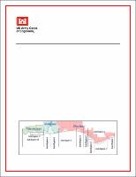 View/Open |