Please use this identifier to cite or link to this item:
https://hdl.handle.net/11681/48279Full metadata record
| DC Field | Value | Language |
|---|---|---|
| dc.contributor.author | United States. Army. Corps of Engineers. Omaha District | - |
| dc.date.accessioned | 2024-03-06T20:56:40Z | - |
| dc.date.available | 2024-03-06T20:56:40Z | - |
| dc.date.issued | 2013-04 | - |
| dc.identifier.uri | https://hdl.handle.net/11681/48279 | - |
| dc.description | Technical Report | en_US |
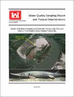
| dc.description.abstract | project is being proposed to expand and enhance previously constructed shallow-water habitat (SWH) along the Missouri River at Glovers Point Bend in Thurston County, Nebraska. The U.S. Army Corps of Engineers (USACE) is constructing SWH along the lower Missouri River downstream of Gavins Point Dam to mitigate aquatic habitat lost from past bank stabilization and channelization. Increasing SWH will enhance habitat for the endangered pallid sturgeon (Scaphirhynchus albus) population along the lower Missouri River. The District is referring to the proposed project as the Glovers Point project. Deposited sediment will be excavated from the area to enhance and expand previously constructed SWH at the project site. Sediment excavation will involve hydraulic dredging with the dredge spoil being discharged to the adjacent Missouri River. It is believed the dredge material will be primarily sand with some silts and clays. An estimated 910,000 cubic yards of material would be excavated and discharged to the Missouri River. The intent of this report is to provide Factual Determinations of the potential water quality impacts of hydraulic dredging discharge at the proposed Glovers Point project on the Missouri River. As defined in the Federal CWA and USACE Regulation No. 1110-2-8154, water quality is defined as the physical, chemical, and biological characteristics of water. | en_US |
| dc.description.sponsorship | United States. Army. Corps of Engineers. | en_US |
| dc.description.tableofcontents | 1 Background information ....................................................................................................................... 1 1.1 Project Description........................................................................................................................ 1 1.2 Project Location............................................................................................................................ 1 1.3 Section 404 Permitting Requirements – 404(b)(1) Guidelines ..................................................... 3 1.4 Section 401 Water Quality Certification....................................................................................... 4 1.5 Water Quality Standards Classifications of the Missouri River ................................................... 4 1.6 Use of Sediment/Soil Analysis, Elutriate Testing, and Ambient Missouri River Water Quality Data for Factual Determinations...................................................................................... 5 2 Site-Specific Water Quality Concerns .................................................................................................. 5 2.1 Fish Consumption Advisory ......................................................................................................... 5 2.2 Section 303(d) Impaired Waters Listings ..................................................................................... 5 2.3 Nutrients........................................................................................................................................ 6 2.4 National Research Council of the National Academies Assessment of Missouri River Water Quality and Sediment Management.............................................................................................. 7 3 Sampling and Analysis Methods........................................................................................................... 8 3.1 Sampling and Analysis Plan ......................................................................................................... 8 3.2 Collection of Sediment/Soil Samples ........................................................................................... 9 3.3 Collection of Receiving Water.................................................................................................... 11 3.4 Elutriate Testing.......................................................................................................................... 11 4 Results................................................................................................................................................. 14 4.1 Receiving Water Field Measurements ........................................................................................ 14 4.2 Particle Size Analysis ................................................................................................................. 14 4.3 Physiochemical Analysis of Sediment/Soil and Receiving Water Samples and Elutriate Testing Results ........................................................................................................................... 15 5 Water Quality Factual Determinations ............................................................................................... 41 5.1 Physical Substrate Determinations.............................................................................................. 41 5.2 Suspended Particulate/Turbidity Determinations ....................................................................... 42 5.3 Contaminant Determinations ...................................................................................................... 43 5.4 Proposed Disposal Site Determinations...................................................................................... 53 5.5 Summary of Water Quality Factual Determinations................................................................... 54 6 References........................................................................................................................................... 59 Attachment 1. Sampling and Analysis Plan for 2012 Elutriate Sampling – Missouri River GloversPoint Bend Enhancement Project Area. Attachment 2. Particle Size Distribution Reports for Collected Sediment and Soil Samples. Attachment 3. Laboratory Reports of Results for Analysis of Collected Sediment, Soil, ReceivingWater, and Prepared Elutriate Samples. | - |
| dc.format.extent | 106 pages / 5.37 MB | - |
| dc.format.medium | - | |
| dc.language.iso | en_US | en_US |
| dc.publisher | United States. Army. Corps of Engineers. Omaha District. | en_US |
| dc.rights | Approved for Public Release; Distribution is Unlimited | - |
| dc.source | This Digital Resource was created in Microsoft Word and Adobe Acrobat | - |
| dc.subject | Water quality | en_US |
| dc.subject | Water--Sampling | en_US |
| dc.subject | Aquatic habitats | en_US |
| dc.subject | Pallid sturgeon | en_US |
| dc.subject | Sedimentation and deposition | en_US |
| dc.subject | Environmental management | en_US |
| dc.subject | Environmental protection | en_US |
| dc.title | Water Quality Sampling Report and Factual Determinations : Results of Sediment Sampling and Elutriate Testing at the Proposed Glovers Point Shallow Water Habitat Project Site | en_US |
| dc.type | Report | en_US |
| Appears in Collections: | Technical Reports | |
Files in This Item:
| File | Description | Size | Format | |
|---|---|---|---|---|
| Water Quality - Sampling and Elutriate Testing - Golvers Point Shallow Water Habitat Project Site_2013.pdf | 5.37 MB | Adobe PDF |  View/Open |