Please use this identifier to cite or link to this item:
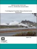
https://hdl.handle.net/11681/48183| Title: | Rhode Island Coastline Coastal Storm Risk Management : Final Integrated Feasibility Study & Environmental Assessment |
| Authors: | United States. Army. Corps of Engineers. New England District |
| Keywords: | Rhode Island--Coasts Northeast storms Storms Shore protection Flood control Environmental management |
| Publisher: | United States. Army. Corps of Engineers. New England District. |
| Abstract: | The U.S. Army Corps of Engineers (USACE), New England District is conducting the feasibility study for the Rhode Island Coastline (RIC), Coastal Storm Risk Management (CSRM) Feasibility Study and prepared the attached Integrated Feasibility Report and Environmental Assessment (IFR/EA). This IFR/EA documents the study process and identifies a Recommended Plan. This plan would address flood risk "along the shoreline and coastal tributaries of southeastern Rhode Island from Narragansett Bay to the Massachusetts border” and Block Island. The Non-Federal Sponsor (NFS) for this study is the state of Rhode Island, Coastal Resource Management Council (RI CRMC). On March 28, 2019, the USACE and the RI CRMC executed a Feasibility Study Agreement (FCSA). The feasibility study was performed with a project cost share of 50 percent Federal funding and 50 percent contributed by the NFS. As a result of Hurricane Sandy, Congress authorized the USACE to undertake the North Atlantic Coast Comprehensive (NACCS) to address flood risks of vulnerable coastal populations in areas affected by the storm. This culminated with the January 2015 completion of the NACCS final report, which identified high-risk focus areas in the North Atlantic region for additional analyses to address coastal storm risk, including the development of strategies to manage risk associated with relative sea level change (RSLC). The RIC study area is one (1) of two (2) high-risk focus areas within the state of Rhode Island that was identified by the NACCS. The study area for the RIC Project runs from Point Judith eastward to the Massachusetts border, including the majority of Narragansett Bay, which is a major feature of the state’s topography. The RIC study area also includes Block Island, which is not located in Narraganset Bay. The area covers more than 457 miles of coastline as shown in Figure ES-1. All or part of 19 municipalities are included in the study area, with more than 650,000 people currently residing within the study boundaries. The period of analysis for the study is a 50-year period, from 2030 through 2079. Project implementation is expected to begin in the year 2025 and last 5 years. The base year is considered the year the alternatives have been implemented and begin to accrue benefits. The base year for this project is assumed to be 2030. The total estimated value of structures and content for structures located within the 100-year floodplain is approximately $3.6 Billion. |
| Description: | Integrated Feasibility Study and Environmental Assessment |
| Rights: | Approved for Public Release; Distribution is Unlimited |
| URI: | https://hdl.handle.net/11681/48183 |
| Appears in Collections: | Environmental Documents |
Files in This Item:
| File | Description | Size | Format | |
|---|---|---|---|---|
| Rhode Island Coastline Coastal Storm Risk Management - FS and EA_2023.pdf | 52.37 MB | Adobe PDF |  View/Open |