Please use this identifier to cite or link to this item:
https://hdl.handle.net/11681/3297Full metadata record
| DC Field | Value | Language |
|---|---|---|
| dc.contributor | Shannon & Wilson | - |
| dc.contributor | George Sills Geotechnical Engineering Consultants | - |
| dc.contributor | Sacramento Area Flood Control Agency | - |
| dc.contributor.author | Kelley, Julie R. | - |
| dc.contributor.author | Vroman, Noah D. | - |
| dc.contributor.author | Groves, Chris | - |
| dc.contributor.author | Harder, Leslie F. | - |
| dc.contributor.author | Sills, George L. | - |
| dc.date.accessioned | 2016-03-16T15:24:49Z | - |
| dc.date.available | 2016-03-16T15:24:49Z | - |
| dc.date.issued | 2009-02 | - |
| dc.identifier.uri | http://hdl.handle.net/11681/3297 | - |
| dc.description | Special Report | - |
| dc.description | Abstract: During spring 2008, the midwestem portion of the continental United States experienced flooding that led to overtopping and levee breaches along several Midwest levee systems. Shortly after the flood, U.S. Army Engineer Research and Development Center and the Sacramento Area Flood Control Agency requested a field team to document field observations of levee performance at four Midwest levee systems. The four levee systems included the East St. Louis Levee system, Pin Oak Levee system, and Cap au Gris Levee system located along the Mississippi River and the Birdland Levee system along the Des Moines River. These levee systems were selected due to their potential to provide valuable information on vegetation impacts on levee performance and failure mechanisms for levees. Post-levee failure conditions were observed at the Pin Oak Levee system, Cap au Gris Levee system, and Birdland Levee system. Levee distress in the form of heavy seepage and sand boils were noted at the East St. Louis Levee system. At the Cap au Gris and Birdland Levee Systems, large trees were present in the vicinity of the levee failures. Roots from these large trees were exposed in the scour hole left from the levee failure and extended a considerable distance from the tree trunk to the levee, and even through the levee. However, based on observations of the inspection, there was no direct evidence that the roots were detrimental to the performance of the levee. NOTE: This file is large. Allow your browser several minutes to download the file. | - |
| dc.description | HDR, Inc. | - |
| dc.publisher | Geotechnical and Structures Laboratory (U.S.) | - |
| dc.publisher | Engineer Research and Development Center (U.S.) | - |
| dc.relation | http://acwc.sdp.sirsi.net/client/en_US/search/asset/1045707 | - |
| dc.relation.ispartofseries | ERDC/GSL SR ; 09-1. | - |
| dc.rights | Approved for public release; distribution is unlimited. | - |
| dc.source | This Digital Resource was created from scans of the Print Resource. | - |
| dc.subject | Animal burrows | - |
| dc.subject | Mississippi River | - |
| dc.subject | Des Moines River | - |
| dc.subject | Levees | - |
| dc.subject | Levee breach | - |
| dc.subject | Sand boils | - |
| dc.subject | Tree roots | - |
| dc.subject | Vegetation | - |
| dc.subject | Flooding | - |
| dc.subject | Flood control | - |
| dc.title | The Spring 2008 Midwest Flood : observations of Missouri and Iowa levee breaches, 21-23 July 2008 | - |
| dc.type | Report | en_US |
| Appears in Collections: | Special Report | |
Files in This Item:
| File | Description | Size | Format | |
|---|---|---|---|---|
| ERDC-GSL-SR-09-1.pdf | 29.12 MB | Adobe PDF | 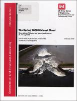 View/Open |