Please use this identifier to cite or link to this item:
https://hdl.handle.net/11681/26727| Title: | Final Mitigation Plan : Marine Benthic Resource Survey, Fort San Geronimo, San Juan, Puerto Rico |
| Authors: | United States. Army. Corps of Engineers. Jacksonville District |
| Keywords: | Shore protection Environmental protection San Juan (P.R.) |
| Publisher: | United States. Army. Corps of Engineers. Jacksonville District. |
| Abstract: | A U.S. Army Corps of Engineers (USACE) sponsored construction project is proposed to protect Fort San Geronimo (Fort) from continued degradation due to wave-induced erosion. To facilitate the environmental commitments of the project, the USACE required documentation and assessment of the current environmental conditions in the vicinity of the Fort and a review of mitigation options, including avoidance and minimization measures to be implemented for the project. To characterize the coral community within the survey area, a combination of video transects and quadrat data were collected as well as mapping of individual colonies. All individual coral colonies with diameters >4.0 inches (>10.2 cm) within the survey area were identified and documented. To document the edge of the seagrass bed within the survey area, biologists first conducted a preliminary reconnaissance swim using snorkel to identify the seagrass bed area. To map the edge of the seagrass bed, the biologist then swam directly above the edge of bed, followed closely behind by a snorkeler using the Trimble Geo-XT handheld Digital Global Positioning System (DGPS) unit, running ArcPad 7.0. Quadrats were conducted by biologists on Self Contained Underwater Breathing Apparatus (SCUBA) to assess the seagrass community assemblage and density. Within the project area and the surrounding habitat, 108 coral colonies were mapped. Of these 108 colonies, 43 colonies will be impacted by the proposed project. To minimize and avoid impacts to these corals, a recipient site has been identified and the protocols to relocate these colonies while reducing stress are covered in detailed in this mitigation plan. In addition to addressing the coral impacts, this mitigation plan describes the USACE’s commitment to minimize and avoid impacts to seagrass and water quality during the construction of the revetment and temporary access road. The functions and values that will be maintained resulting from this mitigation effort will be the minimization of the overall reduction of loss of phenotypic genetic composition of corals through the transplantation process. |
| Description: | Mitigation Plan |
| Rights: | Approved for Public Release; Distribution is Unlimited |
| URI: | http://hdl.handle.net/11681/26727 |
| Appears in Collections: | Environmental Documents |
Files in This Item:
| File | Description | Size | Format | |
|---|---|---|---|---|
| San_Geronimo_Final_MitigationPlan_20110215[1].pdf | 59.35 MB | Adobe PDF | 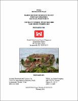 View/Open |