Please use this identifier to cite or link to this item:
https://hdl.handle.net/11681/22801Full metadata record
| DC Field | Value | Language |
|---|---|---|
| dc.contributor.author | Little, Charles D., 1946- | - |
| dc.contributor.author | Biedenharn, David S. | - |
| dc.contributor.author | Allison, Mead A. | - |
| dc.contributor.author | McCullough, Troy | - |
| dc.contributor.author | Wofford, Koby | - |
| dc.date.accessioned | 2017-08-07T13:27:38Z | - |
| dc.date.available | 2017-08-07T13:27:38Z | - |
| dc.date.issued | 2017-07 | - |
| dc.identifier.uri | http://hdl.handle.net/11681/22801 | - |
| dc.identifier.uri | http://dx.doi.org/10.21079/11681/22801 | - |
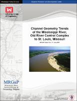
| dc.description.abstract | Abstract: A geometric data analysis was conducted for the Mississippi River from the Old River Control Complex to St. Louis, MO, or approximately River Mile 325 Above Head of Passes to RM 180 Above Mouth of Ohio River. The purpose of the study was to document long-term trends in the dimension, pattern, and profile of the Mississippi River channel within the study reach. Hydrographic survey data from 1956 to 2013 were used to determine spatial and temporal variations in channel geometry and volume. Trends of geometric change in the channel were identified along defined geomorphic reaches of the river. Observed trends indicate the lower portion of the study reach from Old River to Vicksburg, MS, has experienced a general decrease in channel area and volume. Conversely, the reach from Helena, AR, to Hickman, KY, has undergone a general increase in area and volume. The reach of the middle Mississippi River above Cairo, IL, has seen a slight lowering of the channel. The results of this study will be part of a detailed geomorphic assessment of the Mississippi River to be conducted as part of the ongoing Mississippi River Geomorphology and Potamology Program sponsored by the U.S. Army Corps of Engineers, Mississippi Valley Division Science and Technology Office. | en_US |
| dc.description.sponsorship | Mississippi River Geomorphology and Potamology Program (U.S.) | en_US |
| dc.language.iso | en | en_US |
| dc.publisher | United States. Army. Corps of Engineers. Mississippi Valley Division. | en_US |
| dc.publisher | United States. Mississippi River Commission. | en_US |
| dc.publisher | Coastal and Hydraulics Laboratory (U.S.) | en_US |
| dc.publisher | Engineer Research and Development Center (U.S.) | en_US |
| dc.relation.ispartofseries | MRG&P;Report No. 11 | - |
| dc.subject | Geomorphology | en_US |
| dc.subject | Hydrographic surveying | en_US |
| dc.subject | Mississippi River | en_US |
| dc.subject | Potamology | en_US |
| dc.subject | River channels | en_US |
| dc.subject | Stream channelization | en_US |
| dc.title | Channel geometry trends of the Mississippi River, Old River Control Complex to St. Louis, Missouri | en_US |
| dc.type | Report | en_US |
| Appears in Collections: | MRG&P Report | |
Files in This Item:
| File | Description | Size | Format | |
|---|---|---|---|---|
| MRG&P Report No 11.pdf | 27.03 MB | Adobe PDF |  View/Open |