Please use this identifier to cite or link to this item:
https://hdl.handle.net/11681/9039Full metadata record
| DC Field | Value | Language |
|---|---|---|
| dc.contributor.author | Gatto, Lawrence W. | - |
| dc.contributor.author | Merry, C. J. | - |
| dc.contributor.author | McKim, H. L. (Harlan L.) | - |
| dc.contributor.author | Lawson, Daniel E. | - |
| dc.date.accessioned | 2016-06-20T13:39:59Z | - |
| dc.date.available | 2016-06-20T13:39:59Z | - |
| dc.date.issued | 1980-01 | - |
| dc.identifier.uri | http://hdl.handle.net/11681/9039 | - |
| dc.description | CRREL Report | - |
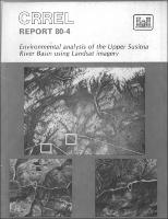
| dc.description | Abstract: The primary objectives of this study were to 1) prepare a map from Landsat imagery of the Upper Susitna River Basin drainage network, lakes, glaciers and snowfields, 2) identify possible faults and lineaments within the upper basin and within a 100-km radius of the proposed Devil Canyon and Watana dam sites as observed on Landsat imagery, and 3) prepare a Landsat-derived map showing the distribution of surficial geologic materials and poorly drained areas. The EROS Digital Image Enhancement System (EDIES) provided computer-enhanced images of Landsat-1 scene 5470-19560. The EDIES false color composite of this scene was used as the base for mapping drainage network, lakes, glaciers and snowfields, six surficial geologic materials units and poorly drained areas. We used some single-band and other color composites of Landsat images during interpretation. All the above maps were prepared by photointerpretation of Landsat images without using computer analysis, aerial photographs, field data, or published reports. These other data sources were used only after the mapping was completed to compare and verify the information interpreted and delineations mapped from the Landsat images. Four Landsat-1 MSS band 7 winter scenes were used in the photomosaic prepared for the lineament mapping. We mapped only those lineaments related to reported regional tectonics, although there were many more lineaments evident on the Landsat photomosaic. Landsat imagery provided useful information on the major drainage patterns, distribution and reflectivity of lakes, geologic features at the terminus of large glaciers, medial and lateral glacial moraines and geologic lineaments. Interpretation of the Landsat imagery for mapping surficial geologic materials without previous knowledge of the past and present sedimentary environments of the study area is difficult and the use of the results may be limited. Satellite and aircraft imagery are more accurately interpreted when the interpreter is familiar with the types of environments present. Landsat imagery provided geologic information in a remote area quickly and cost-effectively. It also provided preliminary planning information and indicated regional differences. It will not, however, supply the detailed site-specific data required for design. Ground truth data are required for all remote sensing investigations using satellite or aircraft data. | - |
| dc.publisher | Cold Regions Research and Engineering Laboratory (U.S.) | - |
| dc.publisher | Engineer Research and Development Center (U.S.) | - |
| dc.relation | http://acwc.sdp.sirsi.net/client/en_US/search/asset/1001161 | - |
| dc.relation.ispartofseries | CRREL report ; 80-4. | - |
| dc.rights | Approved for public release; distribution is unlimited. | - |
| dc.source | This Digital Resource was created from scans of the Print Resource | - |
| dc.subject | Environmental mapping | - |
| dc.subject | Landsat satellites | - |
| dc.subject | Sustina River, Alaska | - |
| dc.subject | Aerial photography | - |
| dc.subject | Environmental surveys | - |
| dc.subject | Mapping | - |
| dc.subject | Satellites (artificial) | - |
| dc.title | Environmental analysis of the Upper Susitna River Basin using Landsat imagery | - |
| dc.type | Report | en_US |
| Appears in Collections: | CRREL Report | |
Files in This Item:
| File | Description | Size | Format | |
|---|---|---|---|---|
| CR-80-4.pdf | 5.42 MB | Adobe PDF |  View/Open |