Please use this identifier to cite or link to this item:
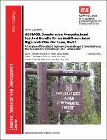
https://hdl.handle.net/11681/8485| Title: | GEOTACS : countermine computational testbed results for an undifferentiated highlands climatic zone, Part 1 : A comparison of field-collected electro-optical/infrared imagery to simulation results from the countermine computational testbed, soil model only |
| Authors: | Geotechnical and Structures Laboratory (U.S.) Coastal and Hydraulics Laboratory (U.S.) Environmental Laboratory (U.S.) Rocky Mountain Research Station (Fort Collins, Colo.) Eslinger, Owen J. Hines, Amanda M. Winton, Corey W. Howington, Stacy E. Goodson, Ricky A. Kala, Raju V. Fairley, Joshua R. Price, Stephanie J. Elder, Kelly |
| Keywords: | Computational testbed Computer models Computer modeling Electro-optical/infrared EO/IR Geophysical modeling and imaging Model validation Modeling and simulation Remote sensing Military Engineering |
| Publisher: | Information Technology Laboratory (U.S.) Engineer Research and Development Center (U.S.) |
| Series/Report no.: | ERDC TR ; 12-13. |
| Description: | Technical Report Abstract: The Geoenvironmental Tactical Sensor Simulation program was established to develop high-fidelity computer models to predict and improve the performance of remote sensor systems. Specifically, electrooptical/infrared systems were studied. The reliability of any remote sensor varies based on a wide array of factors, including the weather/climate conditions and functional setting. Proper understanding of the underlying physics and the influence of the environment, can aid in the development of new sensors and the deployment of existing ones. Naturally, the performance of such sensor systems will vary in different regions and climates. To demonstrate the robustness of the program’s numerical modeling technique, multiple validation efforts were undertaken in several climatic zones covering more than 75 percent of the earth’s landmass. This report summarizes the validation effort for an Undifferentiated Highlands climatic zone. These climatic regions are at high altitude with rugged terrain. A physical data collection effort was executed at an elevation of 3,430 m during September 2011 within the Fraser Experimental Forest in Colorado, USA. A virtual environment was then made to re-create many of the minute details of the physical site. Simulations were run to validate the computational models in the infrared. Good agreement was obtained between the field data and computational results. |
| Rights: | Approved for public release; distribution is unlimited. |
| URI: | http://hdl.handle.net/11681/8485 |
| Appears in Collections: | Technical Report |
Files in This Item:
| File | Description | Size | Format | |
|---|---|---|---|---|
| ERDC-TR-12-13.pdf | 1.87 MB | Adobe PDF |  View/Open |