Please use this identifier to cite or link to this item:
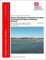
https://hdl.handle.net/11681/7688| Title: | Effects of breakwater construction on Tedious Creek small craft harbor and estuary, Maryland |
| Authors: | United States. Army. Corps of Engineers. Baltimore District Donnell, Barbara P. Briggs, Michael Jeffrey Demirbilek, Zeki Pratt, Thad C. Tubman, Michael W. (Michael Wright), 1951- Carver, Robert D. Nook, Karen M. |
| Keywords: | Breakwater CGWAVE wave modeling Field data collection to support numerical modeling Field monitoring Small boat harbor STWAVE and STB3 wave modeling TABS-MD (RMA2 and RMA4) hydrodynamic modeling and flushing analysis Tedious Creek, Maryland |
| Publisher: | Coastal and Hydraulics Laboratory (U.S.) Engineer Research and Development Center (U.S.) |
| Series/Report no.: | ERDC/CHL TR ; 06-16. |
| Description: | Technical report Tedious Creek is a small, funnel-shaped estuary located on the eastern shoreline of the Chesapeake Bay in Dorchester County, MD. Prior to the construction of the breakwater in 1997, the orientation of Tedious Creek allowed the transmission of storm waves that, at times, caused substantial damage to local vessels. The breakwater differed in geometry from the plans tested in 1994. Foundation problems encountered in the field resulted in a shortening of the breakwater, and a wider opening between the two breakwater sections resulted. Local watermen complained that the breakwater was not providing the authorized level of protection at the county boat dock and public piers on the south shore. It was suggested that the as-built 122-m (400-ft) gap opening should be reduced to the authorized 91-m (300-ft) gap opening. The objective of the Monitoring Completed Navigation Projects study was to determine if the harbor and its structures were performing (both functionally and structurally) as predicted by model studies used in the project design. Specific field data would be obtained and analyzed. These data were used in numerical simulation modeling to ascertain the level of wave protection provided by the as-built breakwater structure, and to compare this level of protection to that which would have been provided if the authorized structure had been built. A third hypothetical structure with a 61-m (200-ft) gap opening also was evaluated. No adverse environmental effects such as breakwater deterioration, shoreline erosion, or scour near the breakwater could be ascertained by analyses of these data. Wave height transformations were performed with varying wave heights, tides, storm surge levels, and incident wave angles using numerical models STWAVE (no diffraction), STB3 (diffraction), and CGWAVE (refraction, diffraction, and energy losses). Evaluations were performed for (a) storm waves, as-built and authorized structures, (b) moderate waves, as-built and authorized structures, (c) typical daily waves, as-built and authorized structures, and (d) storm and typical daily waves, hypothetical structure. For all wave conditions, any reduction in wave heights at the county boat dock and public piers by reducing the gap opening in the breakwater from the as-built to the authorized opening would be minimal and insignificant. Reduction of the gap to the hypothetical 61-m (200-ft) opening resulted in about a 10-percent reduction in typical daily condition (considered insignificant) and modification of the structure to this degree (from as-built 122-m (400-ft) gap to hypothetical 61-m (200-ft)) would not be justified. The functionality of circulation and flushing of the as-built condition was evaluated by applying two models (RMA2 and RMA4) within the TABS-MD suite of numerical models. RMA2 was used to demonstrate general hydrodynamic circulation patterns resulting from verification of the August 2001 field data. RMA4 was used to analyze harbor flushing. The as-built condition appears to maintain good harbor circulation, with velocities below any threat to boats that frequent the harbor. RMA4 flushing tests indicate that the harbor has adequate flushing, and compares favorably to the no-structure flushing test. Moreover, field data and observations made by the Baltimore District during project location site visits indicate that wave conditions preventing satisfactory operations at the county boat dock facility often result from northwesterly waves generated locally on Tedious Creek, rather than by waves propagating through the breakwater gap from a northeasterly direction. |
| Rights: | Approved for public release; distribution is unlimited. |
| URI: | http://hdl.handle.net/11681/7688 |
| Appears in Collections: | Technical Report |
Files in This Item:
| File | Description | Size | Format | |
|---|---|---|---|---|
| CHL-TR-06-16.pdf | 10.24 MB | Adobe PDF |  View/Open |