Please use this identifier to cite or link to this item:
https://hdl.handle.net/11681/7599| Title: | Geology and historical evolution of Sheldon Marsh Nature Preserve, Lake Erie, Ohio |
| Authors: | United States. Army. Corps of Engineers. Buffalo District Morang, Andrew, 1953- Chader, Shanon A. |
| Keywords: | Beach erosion Cedar Point Lake Erie Littoral transport Sediment loss Sheldon Marsh Nature Preserve |
| Publisher: | Coastal and Hydraulics Laboratory (U.S.) Engineer Research and Development Center (U.S.) |
| Series/Report no.: | ERDC/CHL TR ; 05-11. |
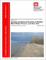
| Description: | Technical report Sheldon Marsh Nature Preserve is located on the southwestern shore of Lake Erie on the southeast end of the 10.5-km-long Cedar Point sand spit. The preserve resembles an inverted “L” with a 1.8-km-long barrier beach that fronts Lake Erie and shields a wetland area. The center of the beach is at 82°36'42"W longitude and 41°25'26"N latitude (NAD83). Sheldon Marsh only covers 465 acres, but its ecological importance cannot be overemphasized. The marsh is a unique habitat and is a critical stopover for migratory birds. The beach has suffered severe erosion since the 1950s, and protection and partial restoration of the sand barrier is essential to the survival of existing and future plant and animal communities. Retreat of the shoreline at the preserve has been a continuing problem throughout the 20th century. Between 1937 and 2003, the beach retreated an average of 360 m. This averages to 5.4 m/year, but the retreat was episodic, with years of rapid retreat interspersed with periods of relative stability. The beach has been relatively stable during lower lake levels (post-1998). A water level rise in the future due to climatological factors (e.g., increased rainfall, less evaporation because of cloud cover, unexpected snowmelt), would subject the barrier to significant damage from storm waves. The main cause of erosion along the Ohio shore is a lack of littoral sediment. The most immediate contributor To the sediment loss in the Sheldon Marsh area is the Huron jetties, only 4,900 m to the southeast. Because of the sheltering effect of the confined disposal facility at the Huron west jetty, significant amounts of sediment have been trapped next to the west jetty, thereby further depriving the littoral system of sediment. A lack of sediment indicates that erosion of the Sheldon Marsh barrier will occur under all Lake Erie water levels. However, higher water level will make the barrier narrower and therefore more vulnerable to breaches or overwash. During low-water periods, downcutting may occur offshore, allowing storm waves to reach the beach with less frictional loss. |
| Rights: | Approved for public release; distribution is unlimited. |
| URI: | http://hdl.handle.net/11681/7599 |
| Appears in Collections: | Technical Report |
Files in This Item:
| File | Description | Size | Format | |
|---|---|---|---|---|
| CHL-TR-05-11.pdf | 4.09 MB | Adobe PDF |  View/Open |