Please use this identifier to cite or link to this item:
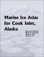
https://hdl.handle.net/11681/5451| Title: | Marine ice atlas for Cook Inlet, Alaska |
| Authors: | Mulherin, Nathan D. Tucker, W. B. Smith, Orson P. Lee, William J. |
| Keywords: | Cook Inlet (Alaska) Sea ice--Alaska--Cook Inlet--Maps |
| Publisher: | Cold Regions Research and Engineering Laboratory (U.S.) Engineer Research and Development Center (U.S.) |
| Series/Report no.: | ERDC/CRREL ; TR-01-10 |
| Abstract: | Cook Inlet, a 350-km-long estuary located in south-central Alaska, is a region of great importance to the economy of the entire state. Approximately half the population of Alaska resides near its shores, and Anchorage, at its northern end, is the state’s largest city and a focus for commerce, industry, recreation, and transportation. Tidal height variations at Anchorage are the second most extreme in the world, exceeded only by those in Canada’s Bay of Fundy. Cook Inlet’s extreme tidal range and the shallow bathymetry produce extreme tidal currents as well. During winter the marine ice that forms in the Inlet can have a substantial impact on human activities. This report is a compilation of previously published and unpublished information on the climatic, meteorological, oceanographic, and hyrodynamic conditions that influence the marine ice cover in Cook Inlet. Biweekly maps, based on historical conditions from 1984 through 1999, are presented that show the expected concentrations and stages of development of the ice cover. These maps were produced by re-analyzing approximately 675 archived ice charts that were produced by the National Weather Service between 1984 and 1999, using ArcViewTM GIS software. |
| Description: | Technical Report |
| Gov't Doc #: | ERDC/CRREL TR-01-10 |
| URI: | http://hdl.handle.net/11681/5451 |
| Appears in Collections: | Technical Report |
Files in This Item:
| File | Description | Size | Format | |
|---|---|---|---|---|
| CRREL-TR-01-10.pdf | 26.07 MB | Adobe PDF |  View/Open |