Please use this identifier to cite or link to this item:
https://hdl.handle.net/11681/5192Full metadata record
| DC Field | Value | Language |
|---|---|---|
| dc.contributor.author | Williams, S. Jeffress | - |
| dc.contributor.author | Carter, Charles H. (Charles Henry) | - |
| dc.contributor.author | Meisburger, Edward P. | - |
| dc.contributor.author | Fuller, Jonathan A. | - |
| dc.date.accessioned | 2016-03-21T14:17:08Z | - |
| dc.date.available | 2016-03-21T14:17:08Z | - |
| dc.date.issued | 1980-11 | - |
| dc.identifier.uri | http://hdl.handle.net/11681/5192 | - |
| dc.description | Miscellaneous Report | - |
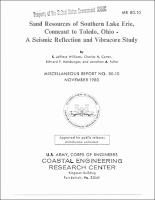
| dc.description | Abstract: About 2,250 square kilometers of the Lake Erie bottom between Conneaut and Toledo, about 25 percent of Ohio's open lake part of Lake Erie, was surveyed to assess potential sand and gravel resources. Primary survey data consist of 690 kilometers of high-resolution seismic reflection profiles between Conneaut and Toledo; 58 vibracores with a maximum length of 6.1 meters were also taken between Conneaut and Marblehead, Ohio. Survey limits were generally from the -7.5-meter depth contour to about the -14-meter depth contour, a maximum of about 16 kilometers offshore. | - |
| dc.publisher | Coastal Engineering Research Center (U.S.) | - |
| dc.publisher | Engineer Research and Development Center (U.S.) | - |
| dc.relation | http://acwc.sdp.sirsi.net/client/en_US/search/asset/1007446 | - |
| dc.relation.ispartofseries | Miscellaneous report (Coastal Engineering Research Center (U.S.)) ; no. 80-10. | - |
| dc.rights | Approved for Public Release, Distribution is Unlimited | - |
| dc.source | This Digital Resource was created from scans of the Print Resource | - |
| dc.subject | Geomorphology | - |
| dc.subject | Lake Erie | - |
| dc.subject | Ohio | - |
| dc.subject | Sand Resources | - |
| dc.subject | Sediments | - |
| dc.subject | Seismic Reflection | - |
| dc.subject | Vibracores | - |
| dc.title | Sand resources of southern Lake Erie, Conneaut to Toledo, Ohio: a seismic reflection and vibracore study | - |
| dc.type | Report | en_US |
| Appears in Collections: | Miscellaneous Report | |
Files in This Item:
| File | Description | Size | Format | |
|---|---|---|---|---|
| MR-CERC-80-10.pdf | 17.9 MB | Adobe PDF |  View/Open |