Please use this identifier to cite or link to this item:
https://hdl.handle.net/11681/45162Full metadata record
| DC Field | Value | Language |
|---|---|---|
| dc.contributor.author | Savant, Gaurav, 1979- | - |
| dc.contributor.author | Brown, Gary L. | - |
| dc.contributor.author | Ayres, Steven K. | - |
| dc.creator | Coastal and Hydraulics Laboratory (U.S.) | - |
| dc.date.accessioned | 2022-08-19T14:12:13Z | - |
| dc.date.available | 2022-08-19T14:12:13Z | - |
| dc.date.issued | 2022-08 | - |
| dc.identifier.govdoc | MRG&P Report No. 41; Volume 6 | - |
| dc.identifier.uri | https://hdl.handle.net/11681/45162 | - |
| dc.identifier.uri | http://dx.doi.org/10.21079/11681/45162 | - |
| dc.description | MRG&P Report | en_US |
| dc.description.abstract | This report is part of the (OMAR) Assessment (defined herein), intended to provide a comprehensive assessment of the interconnected Mississippi, Red, and Atchafalaya Rivers, and the potential results of various changes. This report details the multi-dimensional modeling efforts undertaken to characterize the hydrodynamic and morphodynamic response of the Mississippi River to both the existing configuration and to various proposed operational, dredging, and structural scenarios. | en_US |
| dc.description.sponsorship | Mississippi River Geomorphology and Potamology Program (U.S.) | en_US |
| dc.description.tableofcontents | Abstract .................................................................................................................................... ii Contents .................................................................................................................................. iii Figures and Tables ................................................................................................................... v Preface .................................................................................................................................... ix 1 Introduction ...................................................................................................................... 1 1.1 Background ......................................................................................................... 3 1.2 Objective .............................................................................................................. 3 1.3 Approach ............................................................................................................. 4 1.4 Scope ................................................................................................................... 4 2 Adaptive Hydraulics (AdH) Hydrodynamic and Sediment Modeling and Validation .......................................................................................................................... 5 2.1 Model description ............................................................................................... 5 2.1.1 Adaptive Hydraulics (AdH) and SEDLIB .................................................. 5 2.1.2 AdH/SEDLIB contributions to the study ................................................. 6 2.2 Model application history ................................................................................... 6 2.3 Model creation .................................................................................................... 7 2.4 Model revalidation ........................................................................................... 15 2.4.1 Hydrodynamic revalidation .................................................................. 15 2.4.2 Sediment transport revalidation ......................................................... 20 3 Theoretical Considerations ........................................................................................... 26 3.1 Sediment diversion basics .............................................................................. 26 3.2 Application of sediment diversion basics to the Old River Control Complex (ORCC) ............................................................................................... 29 3.2.1 Mississippi River drawdown and water surface elevation change associated with the introduction of an ORCC-type diversion ............................................................................................... 30 3.2.2 Short-term morphological response of the river to an ORCC-type diversion ....................................................................................... 31 3.2.3 Long-term morphological response of the river to an ORCC-type diversion ....................................................................................... 31 3.2.4 Implications of the theoretical analysis for the analysis of the ORCC ..................................................................................................... 32 4 Base Condition and Scenario Analyses....................................................................... 35 4.1 Metrics for analysis .......................................................................................... 35 4.1.1 Sediment trapping efficiency (STE) ..................................................... 35 4.1.2 Sediment diversion coefficient (SDC) ................................................. 36 4.1.3 Sediment removal ratio (SRR) ............................................................. 37 4.1.4 Sediment removal index (SRI) ............................................................. 37 4.2 Base Condition simulations ............................................................................ 38 4.2.1 Base Condition simulations: morphologic response ......................... 39 4.2.2 Base Condition simulations: sediment diversion coefficient analysis ................................................................................................. 42 4.2.3 Base Condition simulations: sediment removal ratio analysis ......... 47 4.3 Description of scenarios .................................................................................. 48 4.4 Operational scenarios analysis ....................................................................... 51 4.4.1 Qualitative analysis of Mississippi River morphologic response ............................................................................................... 51 4.4.2 Quantitative analysis of sediment removal and Mississippi River morphologic response ................................................................ 60 4.5 Dredging scenarios analysis ........................................................................... 67 4.5.1 Qualitative analysis of Mississippi River morphologic response ............................................................................................... 67 4.5.2 Quantitative analysis of sediment removal and Mississippi River morphologic response ................................................................ 73 4.6 Structural scenarios analysis .......................................................................... 79 4.6.1 Qualitative analysis of Mississippi River morphologic response ............................................................................................... 79 4.6.2 Quantitative analysis of structural scenarios and Mississippi River morphologic response ................................................................ 84 4.7 Summary of Base conditions and scenario analyses .................................... 89 4.7.1 Summary of Base conditions .............................................................. 89 4.7.2 Summary of operational scenarios (Scenarios 3–10) ....................... 90 4.7.3 Summary of dredging scenarios (Scenarios 11–14) ......................... 91 4.7.4 Summary of structural scenarios (Scenarios 15–18) ....................... 91 5 Conclusions and Recommendations ........................................................................... 92 5.1 Conclusions ...................................................................................................... 92 5.2 Recommendations ........................................................................................... 96 References ............................................................................................................................. 98 Abbreviations ...................................................................................................................... 100 Report Documentation Page | - |
| dc.format.extent | 111 pages / 19.42 MB | - |
| dc.format.medium | - | |
| dc.language.iso | en_US | en_US |
| dc.publisher | United States. Army. Corps of Engineers. Mississippi Valley Division. | en_US |
| dc.publisher | United States. Mississippi River Commission. | - |
| dc.publisher | Coastal and Hydraulics Laboratory (U.S.) | - |
| dc.publisher | Engineer Research and Development Center (U.S.) | - |
| dc.relation.ispartofseries | MRG&P Report (Mississippi River Geomorphology and Potamology Program (U.S.)) ; no. MRG&P Report No. 41; Volume 6 | - |
| dc.rights | Approved for Public Release; Distribution is Unlimited | - |
| dc.source | This Digital Resource was created in Microsoft Word and Adobe Acrobat | - |
| dc.subject | Atchafalaya River (La.) | en_US |
| dc.subject | Dredging | en_US |
| dc.subject | Geomorphology | en_US |
| dc.subject | Hydraulic structures | en_US |
| dc.subject | Hydrodynamics | en_US |
| dc.subject | Mississippi River | en_US |
| dc.subject | Old River (La.) | en_US |
| dc.subject | Red River (Tex.-La.) | en_US |
| dc.subject | Sedimentation and deposition | en_US |
| dc.subject | Sediment transport | en_US |
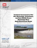
| dc.title | Technical assessment of the Old, Mississippi, Atchafalaya, and Red (OMAR) Rivers : Mississippi River multi-dimensional model | en_US |
| dc.type | Report | en_US |
| Appears in Collections: | MRG&P Report | |
Files in This Item:
| File | Description | Size | Format | |
|---|---|---|---|---|
| MRG&P Report No 41-Vol 6.pdf | 19.42 MB | Adobe PDF |  View/Open |