Please use this identifier to cite or link to this item:
https://hdl.handle.net/11681/42402Full metadata record
| DC Field | Value | Language |
|---|---|---|
| dc.contributor.author | Lasko, Kristofer D. | - |
| dc.contributor.author | Sava, Elena | - |
| dc.date.accessioned | 2021-11-19T16:50:10Z | - |
| dc.date.available | 2021-11-19T16:50:10Z | - |
| dc.date.issued | 2021-11 | - |
| dc.identifier.govdoc | ERDC/GRL TR-21-7 | - |
| dc.identifier.uri | https://hdl.handle.net/11681/42402 | - |
| dc.identifier.uri | http://dx.doi.org/10.21079/11681/42402 | - |
| dc.description | Technical Report | en_US |
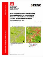
| dc.description.abstract | Land cover type is a fundamental remote sensing-derived variable for terrain analysis and environmental mapping applications. The currently available products are produced only for a single season or a specific year. Some of these products have a coarse resolution and quickly become outdated, as land cover type can undergo significant change over a short time period. In order to enable on-demand generation of timely and accurate land cover type products, we developed a sensor-agnostic framework leveraging pre-trained machine learning models. We also generated land cover models for Sentinel-2 (20m) and Landsat 8 imagery (30m) using either a single date of imagery or two dates of imagery for mapping land cover type. The two-date model includes 11 land cover type classes, whereas the single-date model contains 6 classes. The models’ overall accuracies were 84% (Sentinel-2 single date), 82% (Sentinel-2 two date), and 86% (Landsat 8 two date) across the continental United States. The three different models were built into an ArcGIS Pro Python toolbox to enable a semi-automated workflow for end users to generate their own land cover type maps on demand. The toolboxes were built using parallel processing and image-splitting techniques to enable faster computation and for use on less-powerful machines. | en_US |
| dc.description.sponsorship | Geospatial Research Laboratory (U.S.) | en_US |
| dc.description.tableofcontents | Abstract ............................................................................................................................ ii Figures and Table ............................................................................................................ iv Preface ............................................................................................................................. vi Acronyms and Abbreviations .......................................................................................... vii 1 Introduction ............................................................................................................... 1 1.1 Background ....................................................................................................... 1 1.2 Image classification .......................................................................................... 3 1.2.1 Support vector machines ................................................................................................... 4 1.2.2 Classifier training ............................................................................................................... 4 1.2.3 Classification accuracy assessment ................................................................................. 5 1.3 Objectives .......................................................................................................... 6 2 Data and Training Sites ............................................................................................ 8 2.1 Landsat 8 and Sentinel-2 imagery .................................................................. 8 2.2 Description of training sites ............................................................................. 9 2.3 Land cover datasets ...................................................................................... 10 3 Methodology ............................................................................................................ 12 3.1 Methodology .................................................................................................. 12 3.2 Python toolbox design ................................................................................... 16 3.2.1 ArcGIS Pro Python toolbox background .......................................................................... 16 3.2.2 ETP Land Cover mapping Python toolboxes ................................................................... 17 3.3 Training data .................................................................................................. 20 3.4 Model training ................................................................................................ 21 4 Example Output and Model Evaluation .................................................................. 22 4.1 Example output .............................................................................................. 22 4.2 Accuracy assessment .................................................................................... 26 4.3 Advancements with synthetic training data for sensor agnostic mapping 30 4.4 Installation and usage of ArcGIS Pro Tools .................................................. 34 Conclusion ..................................................................................................................... 35 References .................................................................................................................... 36 Report Documentation Page | - |
| dc.format.extent | 47 pages / 5.84 MB | - |
| dc.format.medium | - | |
| dc.language.iso | en_US | en_US |
| dc.publisher | Geospatial Research Laboratory (U.S.) | en_US |
| dc.publisher | Engineer Research and Development Center (U.S.) | - |
| dc.relation.ispartofseries | Technical Report (Engineer Research and Development Center (U.S.));no. ERDC/GRL TR-21-7 | - |
| dc.rights | Approved for Public Release; Distribution is Unlimited | - |
| dc.source | This Digital Resource was created in Microsoft Word and Adobe Acrobat | - |
| dc.subject | Land cover--Remote sensing | en_US |
| dc.subject | Machine learning | en_US |
| dc.subject | Python (Computer program language) | en_US |
| dc.subject | ArcGIS | en_US |
| dc.subject | Geographic information systems | en_US |
| dc.title | Semi-automated land cover mapping using an ensemble of support vector machines with moderate resolution imagery integrated into a custom decision support tool | en_US |
| dc.type | Report | en_US |
| Appears in Collections: | Technical Report | |
Files in This Item:
| File | Description | Size | Format | |
|---|---|---|---|---|
| ERDC-GRL TR-21-7.pdf | 5.84 MB | Adobe PDF |  View/Open |