Please use this identifier to cite or link to this item:
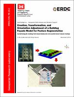
https://hdl.handle.net/11681/35115| Title: | Creation, transformation, and orientation adjustment of a building façade model for feature segmentation : transforming 3D building point cloud models into 2D georeferenced feature overlays |
| Authors: | Blundell, S. Bruce Devine, Philip M. |
| Keywords: | Buildings--Three-dimensional modeling Buildings--Facades Geospatial data Terrestrial lidar scanning Point cloud Elevation model Feature extraction Geographic information systems |
| Publisher: | Geospatial Research Laboratory (U.S.) Engineer Research and Development Center (U.S.) |
| Series/Report no.: | Technical Report (Engineer Research and Development Center (U.S.)) ; no. ERDC/GRL TR-19-2 |
| Abstract: | This project involves the creation of 3-dimensional models of building façades from ground-derived point clouds and extracting features from the façades as encoded overlays. These features include balconies, window wells, overhangs, or other exterior fixtures. Point data of a building façade, acquired from high-resolution terrestrial scans, are transformed in space so that a normal to the façade surface is in the vertical direction. The point cloud is then converted into a gridded model, which can be investigated in like manner to a digital terrain model through breakline, elevation difference, and slope analysis. A backplane of constant z values is created underneath the façade to act as a “bare earth” surface. The orientation of the backplane in space is carefully adjusted to be parallel to the façade’s exterior, providing more accurate feature extraction through difference analysis. Raster overlays are created as color-mapped classes or continuous values of breakline, elevation difference, or slope that capture the form of façade feature objects. To complete the attribution of façade features, georeferencing information from the original building model is associated with each overlay product. This allows for the display of the overlays in a georeferenced visualization environment such as a Geographic Information System or Google Earth. |
| Description: | Technical Report |
| Gov't Doc #: | ERDC/GRL TR-19-2 |
| Rights: | Approved for Public Release; Distribution is Unlimited |
| URI: | https://hdl.handle.net/11681/35115 http://dx.doi.org/10.21079/11681/35115 |
| Appears in Collections: | Technical Report |
Files in This Item:
| File | Description | Size | Format | |
|---|---|---|---|---|
| ERDC-GRL TR-19-2.pdf | 3.14 MB | Adobe PDF |  View/Open |