Please use this identifier to cite or link to this item:
https://hdl.handle.net/11681/3126Full metadata record
| DC Field | Value | Language |
|---|---|---|
| dc.contributor | United States. Mississippi River Commission | - |
| dc.contributor.author | U.S. Army Engineer Waterways Experiment Station | - |
| dc.date.accessioned | 2016-03-16T14:45:45Z | - |
| dc.date.available | 2016-03-16T14:45:45Z | - |
| dc.date.issued | 1955-06 | - |
| dc.identifier.uri | http://hdl.handle.net/11681/3126 | - |
| dc.description | Potamology Report | - |
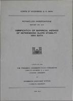
| dc.description | Introduction: The purpose of the investigation reported herein is to evaluate soils data collected by means of routine borings made along the banks of the Lower Mississippi River in late 1953 and 1954 to determine the validity of an empirical method of determining susceptibility of riverbanks to flow slides and/or liquefaction type failures. | - |
| dc.publisher | U.S. Army Engineer Waterways Experiment Station. | - |
| dc.publisher | Engineer Research and Development Center (U.S.) | - |
| dc.relation | http://acwc.sdp.sirsi.net/client/en_US/search/asset/1031580 | - |
| dc.relation.ispartofseries | Potamology investigations report ; no. 12-4. | - |
| dc.rights | Approved for public release; distribution is unlimited. | - |
| dc.source | This Digital Resource was created from scans of the Print Resource | - |
| dc.subject | Potamology | - |
| dc.subject | Mississippi River | - |
| dc.subject | Soils | - |
| dc.subject | Soil mechanics | - |
| dc.subject | Soil testing | - |
| dc.subject | Soil tests | - |
| dc.subject | Soil sampling | - |
| dc.subject | Soils data | - |
| dc.subject | Slope stability | - |
| dc.subject | River banks | - |
| dc.subject | Bank erosion | - |
| dc.subject | Methodology | - |
| dc.subject | Methods | - |
| dc.subject | Flow failure | - |
| dc.subject | Soil liquefaction | - |
| dc.title | Verification of empirical method of determining slope stability, 1954 data | - |
| dc.type | Report | en_US |
| Appears in Collections: | Potamology Investigations Report | |
Files in This Item:
| File | Description | Size | Format | |
|---|---|---|---|---|
| Potamology-Investigations-Report-No-12-4.pdf | 4.62 MB | Adobe PDF |  View/Open |