Please use this identifier to cite or link to this item:
https://hdl.handle.net/11681/2788Full metadata record
| DC Field | Value | Language |
|---|---|---|
| dc.contributor.author | Langway, Chester C., 1929- | - |
| dc.date.accessioned | 2016-03-14T19:49:12Z | - |
| dc.date.available | 2016-03-14T19:49:12Z | - |
| dc.date.issued | 1959-07 | - |
| dc.identifier.uri | http://hdl.handle.net/11681/2788 | - |
| dc.description | Special Report | - |
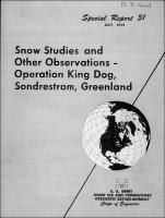
| dc.description | Summary: The objective of Operation King Dog was two-fold: (1) to select a winter access route from Sondrestrom Air Base over rough terrain, river and lake ice to the edge of the Greenland Ice Cap (SOTO); and (2) to decide upon the best possible route from the edge of the Ice Cap through the hummocky ablation zone and crevasse areas to the firn line and out onto the dry snow. This report presents a general description of the route and briefly discusses the results of observations along the trail. | - |
| dc.publisher | U.S. Army Snow, Ice, and Permafrost Research Establishment. | - |
| dc.publisher | Engineer Research and Development Center (U.S.) | - |
| dc.relation | http://acwc.sdp.sirsi.net/client/en_US/search/asset/1023300 | - |
| dc.relation.ispartofseries | Special report (U.S. Army Snow | - |
| dc.rights | Approved for public release; distribution is unlimited. | - |
| dc.source | This Digital Resource was created from scans of the Print Resource | - |
| dc.subject | Operation King Dog | - |
| dc.subject | Snow studies | - |
| dc.subject | Snow surveys | - |
| dc.subject | Ice mounds | - |
| dc.subject | Ice surface features | - |
| dc.subject | Snowfall | - |
| dc.subject | Accumulation | - |
| dc.subject | Meteorology | - |
| dc.subject | Meteorological data | - |
| dc.subject | Topograhy | - |
| dc.subject | Topographic features | - |
| dc.subject | Geography | - |
| dc.subject | Snow vehicles | - |
| dc.subject | Snow roads | - |
| dc.subject | Traverses | - |
| dc.subject | Winter navigation | - |
| dc.subject | Greenland | - |
| dc.title | Snow studies and other observations - Operation King Dog, Sondrestrom, Greenland | - |
| dc.type | Report | en_US |
| Appears in Collections: | Special Report | |
Files in This Item:
| File | Description | Size | Format | |
|---|---|---|---|---|
| SIPRE-Special-Report-31.pdf | 12.87 MB | Adobe PDF |  View/Open |