Please use this identifier to cite or link to this item:
https://hdl.handle.net/11681/26465| Title: | Environmental Assessment : Erosion Control Structure for Cell A Dike Raising at Bartram Island Dredged Material Management Area, Duval County, Florida |
| Authors: | United States. Army. Corps of Engineers. Jacksonville District |
| Keywords: | Dredging Dredging spoil Jacksonville (Fla.) |
| Publisher: | United States. Army. Corps of Engineers. Jacksonville District. |
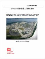
| Abstract: | Bartram Island, formerly known as Quarantine Island, is approximately 4 miles long and varies in width from less than a quarter mile to about one-half mile. It is located in the Jacksonville Harbor portion of the St. Johns River beginning at around River Mile 10 near the westernmost tip of Blount Island and extends along the river's contour to just beyond the mouth of Dunn Creek, (Figure 1). Bartram Island appears on survey maps of the Jacksonville Harbor area as early as 1895, and is apparently a result of dredged material deposition. Bartram Island is owned by the Jacksonville Port Authority (Jaxport) and is an actively managed dredged material placement site and part of dredged material management area (DMMA) component of Jacksonville Harbor and is managed by the U.S. Army Corps of Engineers (USACE). The northern portion of Bartram Island contains two large disposal areas each secured by an earthen dike. These areas are named Cell A and DellB2. Currently these cells are undergoing maintenance to improve their existing dike and to provide additional storage capacity. Pursuant to ER-200-2-2, this activity qualifies as a National Environmental Policy Act (NEPA) Categorical exclusion for the Corps. The dike is being raised to a finished elevation of 55 feet NAVD 1988, accommodating 2.8 M cubic yards of material placement. The project also includes replacing existing weirs with new systems at each cell for improved water drainage. The current dike raising construction activity at Cell A has experienced erosional damage along the toe of the dike slope, most frequently observed on the north side of the Cell A dike. An erosion control alternative is needed in this critical area to prevent additional erosion from occurring at the base of cell dike wall. This NEPA document will evaluate viable alternatives to prevent additional erosion of the dike wall from occurring. The goal of the activity is to ensure the integrity of the dike and prevent sedimentation impact to the fringing salt marsh immediately adjacent to the cell structure. |
| Description: | Environmental Assessment |
| Rights: | Approved for Public Release; Distribution is Unlimited |
| URI: | http://hdl.handle.net/11681/26465 |
| Appears in Collections: | Environmental Documents |
Files in This Item:
| File | Description | Size | Format | |
|---|---|---|---|---|
| BartramErosionControlCell_A_EA_FONSI_Feb2014.pdf | 73.22 MB | Adobe PDF |  View/Open |