Please use this identifier to cite or link to this item:
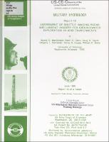
https://hdl.handle.net/11681/22739| Title: | Military hydrology. Report 16, Assessment of shuttle imaging radar and Landsat imagery for ground-water exploration in arid environments |
| Authors: | MacDonald, Harold C. (Harold Carleton), 1930- Clark, Brent C. Taylor, Doug S. Rainwater, Gregory L. Kaupp, Verne H. Waite, William P. |
| Keywords: | Water--Remote sensing Military hydrology Landsat satellites Arid regions |
| Publisher: | Environmental Laboratory (U.S.) |
| Series/Report no.: | Miscellaneous Paper;EL-79-6 Report 16 |
| Abstract: | Abstract: Remote sensor imagery interpretation can provide valuable guides for ground-water exploration. Imagery interpretation affords a reliable, rapid, and cost-effective technique for the identification and analysis of ground-water resources of a given area and is particularly useful in areas for which data or access is limited. Shuttle imaging radars (SIR-A and -B) are part of the National Aeronautics and Space Administration's continuing program of basic and applied research to explore the utility of radar imaging techniques for Earth observations. The shuttle radar of the eastern Sahara provided imagery that allowed for the detection of previously unknown buried stream channels ("radar rivers"). Mapping of such drainage patterns in desert environments can sometimes provide a regional guide to potential groundwater resources. However, the shuttle radar did not provide complete coverage of the eastern Sahara, and in fact, many of the desert areas of the world were not imaged. On the other hand, Landsat data are available for most of the arid and semiarid regions of the Earth, although the use of Landsat imagery to detect "radar rivers" in those areas where no spaceborne radar coverage is available has not been adequately addressed prior to this study. This report provides: (a) an evaluation of the suitability of Landsat imagery to bridge the gap between shuttle radar flight lines, (b) a discussion of the circumstances under which either remote sensor may be superior for detecting relict drainage systems, and (c) an assessment of the value of imaging radar for ground-water exploration in arid regions. This investigation indicates that relict fluvial channels initially inferred on shuttle imagery can be extended and mapped on a regional basis if the Landsat imagery data base is properly selected and processed. In addition, short wavelength aircraft radars may have considerable applicability in sand-covered terrains where differences in surface morphology and texture define relict fluvial channels. Used in a complementary mode, radar imagery and Landsat data can provide an important ground-water exploration technique in arid regions throughout the world. Success of military operations in such desert areas depends on the location of sufficient quantities of water to sustain the force. The utility of SIR and Landsat imagery for mapping relict fluvial channels in arid regions is therefore important to the military, particularly with the attention currently being directed toward Southwest Asia. |
| URI: | http://hdl.handle.net/11681/22739 |
| Appears in Collections: | Miscellaneous Paper |
Files in This Item:
| File | Description | Size | Format | |
|---|---|---|---|---|
| MP EL-79-6 Report 16.pdf | 112.93 MB | Adobe PDF |  View/Open |