Please use this identifier to cite or link to this item:
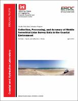
https://hdl.handle.net/11681/22189| Title: | Collection, processing, and accuracy of mobile terrestrial lidar survey data in the coastal environment |
| Authors: | Spore, Nicholas J. Brodie, Katherine L. |
| Keywords: | Coasts Digital elevation models Electronic data processing Optical radar--Evaluation |
| Publisher: | Coastal and Hydraulics Laboratory (U.S.) Engineer Research and Development Center (U.S.) |
| Series/Report no.: | Technical Report (Engineer Research and Development Center (U.S.)) ; no. ERDC/CHL TR-17-5 |
| Abstract: | The purpose of this Coastal and Hydraulics Engineering technical report is to present how elevation data is collected along the coast using terrestrial lidar scanners coupled with a global position system/inertial navigation system and assess the accuracy of the data. A brief overview of the technology utilized on the vehicle platform is presented, along with upcoming improvements. This is followed by a description of the data processing techniques utilized to create three-dimensional point clouds. Subsequent to that is a presentation of an accuracy assessment to provide an overall system performance summary and provide a few examples of data products and their uses. The accuracy assessment of the system resulted in a mean horizontal error of 0.075 meter (m), mean vertical error of 0.099 m, mean total error of 0.129 m, and an average repeatability of 0.05 m. The results of this report suggest that assigning a single accuracy value to a mobile lidar survey may misrepresent some of the spatially variable error throughout the survey, and further work should incorporate full error propagation to each point. |
| Description: | Technical Report |
| Gov't Doc #: | ERDC/CHL TR-17-5 |
| Rights: | Approved for Public Release; Distribution is Unlimited |
| URI: | http://hdl.handle.net/11681/22189 http://dx.doi.org/10.21079/11681/22189 |
| Appears in Collections: | Technical Report |
Files in This Item:
| File | Description | Size | Format | |
|---|---|---|---|---|
| ERDC-CHL TR-17-5.pdf | 4.15 MB | Adobe PDF |  View/Open |