Please use this identifier to cite or link to this item:
https://hdl.handle.net/11681/2145Full metadata record
| DC Field | Value | Language |
|---|---|---|
| dc.contributor.author | Coastal Engineering Research Center (U.S.) | - |
| dc.date.accessioned | 2016-03-11T18:43:09Z | - |
| dc.date.available | 2016-03-11T18:43:09Z | - |
| dc.date.issued | 1983-01 | - |
| dc.identifier.uri | http://hdl.handle.net/11681/2145 | - |
| dc.description | Technical note | - |
| dc.description | Purpose: To provide information on the pipe profile method for measuring changes in the beach and nearshore elevations. | - |
| dc.publisher | Coastal Engineering Research Center (U.S.) | - |
| dc.publisher | Engineer Research and Development Center (U.S.) | - |
| dc.relation | http://acwc.sdp.sirsi.net/client/en_US/search/asset/1000162 | - |
| dc.relation.ispartofseries | Coastal engineering technical note ; CETN-II-9. | - |
| dc.rights | Approved for public release; distribution is unlimited. | - |
| dc.source | This Digital Resource was created from scans of the Print Resource. | - |
| dc.subject | Beach | - |
| dc.subject | Pilings | - |
| dc.subject | Groins | - |
| dc.subject | Nearshore water | - |
| dc.subject | Sand movement | - |
| dc.subject | Sand transport | - |
| dc.subject | Velocity | - |
| dc.title | Pipe profile method for beach surveys | - |
| dc.type | Report | en_US |
| Appears in Collections: | Technical Note | |
Files in This Item:
| File | Description | Size | Format | |
|---|---|---|---|---|
| CETN-II-9.pdf | 277.15 kB | Adobe PDF | 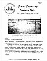 View/Open |