Please use this identifier to cite or link to this item:
https://hdl.handle.net/11681/1926| Title: | A GSSHA model of the Perris Basin of the San Jacinto River watershed, Riverside County, California |
| Authors: | Fong, Moira T. Downer, Charles Wayne Byrd, Aaron R. |
| Keywords: | Air Force Combat Climatology Center Calibration GIS GSSHA Riverside County Flood Control District Perris Basin San Jacinto River Watershed Watershed Modeling System |
| Publisher: | Coastal and Hydraulics Laboratory (U.S.) Engineer Research and Development Center (U.S.) |
| Series/Report no.: | Technical note (Coastal and Hydraulics Engineering (U.S.)) ; III-76. |
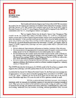
| Description: | Technical note INTRODUCTION: This Coastal and Hydraulics Engineering Technical Note (CHETN) summarizes the results of the development and calibration of a Gridded Surface/Subsurface Hydrologic Analysis (GSSHA) (Downer et al. 2005) model of the northwest region of the San Jacinto River Basin in Riverside County, CA, by the U.S. Army Engineer Research and Development Center (ERDC), in collaboration with The U.S. Army Engineer District, Los Angeles. |
| Rights: | Approved for public release; distribution is unlimited. |
| URI: | http://hdl.handle.net/11681/1926 |
| Appears in Collections: | Technical Note |
Files in This Item:
| File | Description | Size | Format | |
|---|---|---|---|---|
| CHETN-III-76.pdf | 1.23 MB | Adobe PDF |  View/Open |