Please use this identifier to cite or link to this item:
https://hdl.handle.net/11681/1799Full metadata record
| DC Field | Value | Language |
|---|---|---|
| dc.contributor.author | Costa, Steven L. | en_US |
| dc.contributor.author | Glatzel, Karen A. | en_US |
| dc.creator | GDC | en_US |
| dc.creator | Coastal and Hydraulics Laboratory (U.S.) | en_US |
| dc.creator | Coastal Inlets Research Program (U.S.) | en_US |
| dc.date.accessioned | 2016-03-10T21:55:00Z | en_US |
| dc.date.available | 2016-03-10T21:55:00Z | en_US |
| dc.date.issued | 2002-09 | en_US |
| dc.identifier.govdoc | ERDC/CHL CR-02-1 rept.1 | en_US |
| dc.identifier.uri | http://hdl.handle.net/11681/1799 | en_US |
| dc.description | Contract Report | en_US |
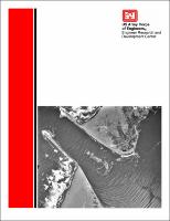
| dc.description.abstract | This data review for Humboldt Bay, CA, was conducted by GDC, LLC, Trinidad, CA, for the U.S. Army Engineer Research and Development Center (ERDC), Coastal and Hydraulics Laboratory (CHL), Vicksburg, MS. The report was prepared by Dr. Steven L. Costa and Dr. Karen A. Glatzel, GDC, under the general direction of Dr. Adele Militello, Coastal Hydrodynamics Branch (CHB), CHL. Work was performed under the Inlet Modeling System (IMS) Work Unit of the Coastal Inlets Research Program (CIRP), Headquarters, U.S. Army Corps of Engineers (HQUSACE). CHL is conducting a study of the entrance to Humboldt Bay, CA, as a part of CIRP. This data review provides a supplementary inventory and review of available data to support the study. The data review includes historical and recent physical processes and engineering data describing Humboldt Bay and the adjacent littoral cell. The focus is on data and data sources related to physical oceanography (tides, wind, waves, currents, hydrographic structure, bathymetry), coastal processes, tidal inlet and beach dynamics, sand supply and budgets, structural modifications controlling the inlet, and dredging. The purpose of the data review, in support of the inlet study of Humboldt Bay, is to locate, identify, and catalog as large a portion of the available data as practicable. The intent is to identify a database that will provide substantial information and knowledge needed to facilitate a successful and complete study of the inlet. Historic data and data sources are needed for the evaluation of the evolution of the inlet and anthropogenic influences during the past 150 years. Recent physical processes data, and data sources, are also needed for framing and simulating the existing physical dynamic attributes of the inlet. Only when both the past evolution and the existing properties of the inlet are understood, can possible approaches to improvements be investigated and identified. | en_US |
| dc.description.sponsorship | Coastal Inlets Research Program (U.S.) | en_US |
| dc.description.sponsorship | United States. Army. Corps of Engineers | en_US |
| dc.description.tableofcontents | 1—Introduction......................................................................................................1 Purpose..............................................................................................................1 Background.......................................................................................................2 Approach...........................................................................................................2 Scope and Limitations.......................................................................................4 2—Description of Study Area...............................................................................6 Physical Setting.................................................................................................6 Physical Oceanography.....................................................................................7 Inlet Operation..................................................................................................8 Adjacent Beaches..............................................................................................8 3—Chronologies of Inlet Development...............................................................11 History of Engineering Projects......................................................................11 Chronology of Key Studies.............................................................................13 Inlet dynamics..........................................................................................15 Physical oceanography.............................................................................15 Beach processes and bay sediments.........................................................16 4—Inventory of Available Data and Data Sources..............................................18 Aerial Photographs..........................................................................................18 Maps and Charts.............................................................................................21 Studies and Reports.........................................................................................22 Data Sources and Compilations......................................................................23 Contact information..................................................................................23 Humboldt Bay GIS...................................................................................23 Nearshore oceanographic studies.............................................................24 Contacts with specialized knowledge and research interest.....................25 References............................................................................................................27 Appendix A: Listing of Aerial Photographs by Date.........................................A1 Appendix B: Abbreviations Used for Map and Chart Origins in Appendix C..B1 Appendix C: Listing of Available Maps and Charts by Date............................C1 Appendix D: Key for Interpreting Codes in List of Maps and Charts...............D1 Appendix E: Annotated Bibliography of Key Studies and Reports....................E1 Appendix F: Available Publications at Humboldt State University Library......F1 Appendix G: List of Contacts............................................................................G1 | en_US |
| dc.format.extent | 127 pages/2.39 MB | en_US |
| dc.format.medium | en_US | |
| dc.language.iso | en_US | en_US |
| dc.publisher | Engineer Research and Development Center (U.S.) | en_US |
| dc.relation | http://acwc.sdp.sirsi.net/client/en_US/search/asset/1000069 | en_US |
| dc.relation.ispartofseries | Contract report (Engineer Research and Development Center (U.S.)) ; no.ERDC/CHL CR-02-1 rept.1 | en_US |
| dc.rights | Approved for public release; distribution is unlimited | en_US |
| dc.source | This Digital Resource was created from scans of the Print Resource | en_US |
| dc.subject | Aerial photography | en_US |
| dc.subject | Bathymetry | en_US |
| dc.subject | Humboldt Bay (Calif.) | en_US |
| dc.subject | Coastal processes | en_US |
| dc.subject | Currents | en_US |
| dc.subject | Dredging | en_US |
| dc.subject | Inlet dynamics | en_US |
| dc.subject | Inlet evolution | en_US |
| dc.subject | Physical oceanography | en_US |
| dc.subject | Physical processes | en_US |
| dc.subject | Sediment budget | en_US |
| dc.subject | Structural modifications | en_US |
| dc.subject | Tides | en_US |
| dc.subject | Winds | en_US |
| dc.subject | Waves | en_US |
| dc.subject | Coastal Inlets Research Program (U.S.) | en_US |
| dc.title | Humboldt Bay, California, entrance channel. Report 1: data review | en_US |
| dc.type | Report | en_US |
| Appears in Collections: | Contract Report Contract Report | |
Files in This Item:
| File | Description | Size | Format | |
|---|---|---|---|---|
| ERDC-CHL-CR-02-1.pdf | ERDC/CHL CR-02-1 rept.1 | 2.39 MB | Adobe PDF |  View/Open |