Please use this identifier to cite or link to this item:
https://hdl.handle.net/11681/13401Full metadata record
| DC Field | Value | Language |
|---|---|---|
| dc.contributor | United States. Army. Corps of Engineers. Norfolk District | - |
| dc.contributor.author | Richards, David R. | - |
| dc.contributor.author | Morton, Michael R. | - |
| dc.date.accessioned | 2016-07-18T15:33:00Z | - |
| dc.date.available | 2016-07-18T15:33:00Z | - |
| dc.date.issued | 1983-06 | - |
| dc.identifier.uri | http://hdl.handle.net/11681/13401 | - |
| dc.description | Technical Report | - |
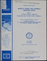
| dc.description | Abstract: This report presents the findings of physical model tests of deepening the approach channels to Norfolk and Newport News, Virginia. The tests included a steady-state portion for the determination of the tide and current velocity effects of channel deepening as well as a dynamic portion where variable tide and freshwater inputs were used to study salinity redistributions. The steady-state tests showed that tides would remain unaffected by channel deepening while the velocity studies indicated some subtle changes caused by the deepening. An overall decrease in velocity amplitude of 0.13 fps was noticed in the deepened condition. This decrease, however, was barely detectable by model instrumentation. Slight increases in flood predominance were noticed under average inflow conditions indicating that salinity intrusion may move upstream in the study area. The dynamic tests served two purposes. First, they were intended to define the salinity patterns in detail throughout the lower Chesapeake Bay which had previously not been done, particularly with regard to the presence of the "neap-spring" salinity response to varying tide conditions. The study detected a strong neap-spring response in the study area and documented its magnitude at each of the stations in the lower Chesapeake Bay. Second and most important was predicting what changes to the existing salinity character of Chesapeake Bay would be brought on by the proposed channel deepening. Salinity sampling stations were located at 193 positions throughout the Chesapeake Bay system with the vast majority being located near the project area in the lower bay and James River areas. A 2-1/2-year weekly stepped variable hydrograph taken from historical records and a 28-lunar-day, 56-cycle, 12-constituent variable tide were used as boundary conditions. Source salinity was maintained at a constant 32 ppt which is indicative of low flow conditions. Results from 65 stations are given in the form of time-histories, plan-minus-base difference plots, depth-averaged and depth-averaged difference plots, isohaline and bottom difference maps. The graphics document the following observations: (A.) Neap-spring variations in salinity stratification are prevalent throughout the lower bay and project areas. Commonly, the variations are as great as 5 to 8 ppt at a given depth. (B.) Channel deepening caused an increase in salinity intrusion that was normally confined to the deepened channel areas. Adjacent shallow-water areas showed very little change in salinity. Areas outside the project area in the upper bay showed no changes that can be associated with channel deepening. (C.) Redistributions of salt within the cross section were noticed in channels with adjacent shallow-water areas. In some cases, the shallow waters freshened as the channels became saltier. (D.) Overall changes to the salinity structure could be characterized by a net increase in depth-averaged salt with an increase in stratification. Bottom variations in the neap-spring response were noticed in the form of damped salinity variations for equivalent tidal inputs. Results of the tests indicate salinity changes to the estuary which can be attributed to channel deepening. On the average, the changes are small, normally less than 2 ppt, in an extremely dynamic portion of the estuary where natural salinity fluctuations due to variations in tides and freshwater input can cause weekly variations an order of magnitude greater. NOTE: This file is large. Allow your browser several minutes to download the file. | - |
| dc.publisher | Hydraulics Laboratory (U.S.) | - |
| dc.publisher | Engineer Research and Development Center (U.S.) | - |
| dc.relation | http://acwc.sdp.sirsi.net/client/en_US/search/asset/1033302 | - |
| dc.relation.ispartofseries | Technical report (U.S. Army Engineer Waterways Experiment Station) ; HL-83-13 rept. 1. | - |
| dc.rights | Approved for public release; distribution is unlimited. | - |
| dc.source | This Digital Resource was created from scans of the Print Resource | - |
| dc.subject | Channel deepening | - |
| dc.subject | Current velocities | - |
| dc.subject | Hydraulic models | - |
| dc.subject | Navigation channels | - |
| dc.subject | Salinity | - |
| dc.subject | Neap-spring salinity response | - |
| dc.subject | Chesapeake Bay | - |
| dc.subject | Estuary | - |
| dc.subject | Estuaries | - |
| dc.subject | Salinity intrusion | - |
| dc.subject | Tides | - |
| dc.subject | Saltwater encroachment | - |
| dc.subject | Norfolk | - |
| dc.subject | Norfolk harbor | - |
| dc.subject | Channel deepening | - |
| dc.subject | Dredging | - |
| dc.subject | Virginia | - |
| dc.title | Norfolk Harbor and channels deepening study. Report 1, Physical model results : Chesapeake Bay hydraulic model investigation | - |
| dc.type | Report | en_US |
| Appears in Collections: | Technical Report | |
Files in This Item:
| File | Description | Size | Format | |
|---|---|---|---|---|
| TR-HL-83-13-Report-1.pdf | 41.43 MB | Adobe PDF |  View/Open |