Please use this identifier to cite or link to this item:
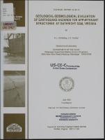
https://hdl.handle.net/11681/12731| Title: | Geological-seismological evaluation of earthquake hazards for appurtenant structures at Gathright Dam, Virginia |
| Authors: | United States. Army. Corps of Engineers. Norfolk District Krinitzsky, E. L. Dunbar, Joseph B. |
| Keywords: | Earthquakes Seismic zoning Seismology Geology Earthquake motions Southwestern Virginia Gathright Lake (Va.) Earthquake prediction Hydraulic structures Earthquake effects |
| Publisher: | Geotechnical Laboratory (U.S.) Engineer Research and Development Center (U.S.) |
| Series/Report no.: | Technical report (U.S. Army Engineer Waterways Experiment Station) ; GL-90-10. |
| Description: | Technical Report Abstract: There are no active faults in the region surrounding Gathright Dam, though a notable earthquake occurred in Giles County about 60 km to the southwest. The Giles County source was interpreted to have a maximum potential of MM IX which attenuates to MM VII at the dam and is the severest event to be expected at that site. Peak horizontal motions at the damsite for a mean plus one sLandard deviation were interpreted as 130 cm/sec^2 for acceleration, 14 cm/sec for velocity, and 11 sec for bracketed duration equal to or greater than 0.05 G. These values are for use as parameters in selecting or scaling accelerograms and response spectra for use in dynamic analyses. A recommended group of accelerograms are included in the report. Note: This file is large. Allow your browser several minutes to download the file. |
| Rights: | Approved for public release; distribution is unlimited. |
| URI: | http://hdl.handle.net/11681/12731 |
| Appears in Collections: | Technical Report |
Files in This Item:
| File | Description | Size | Format | |
|---|---|---|---|---|
| TR-GL-90-10.pdf | 21.61 MB | Adobe PDF |  View/Open |