Please use this identifier to cite or link to this item:
https://hdl.handle.net/11681/11322Full metadata record
| DC Field | Value | Language |
|---|---|---|
| dc.contributor.author | Schmeidel, Glenn W. | - |
| dc.date.accessioned | 2016-06-20T14:18:09Z | - |
| dc.date.available | 2016-06-20T14:18:09Z | - |
| dc.date.issued | 1978-05 | - |
| dc.identifier.uri | http://hdl.handle.net/11681/11322 | - |
| dc.description | Technical report | - |
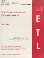
| dc.description | Abstract: This report covers a test of how accurately a map-referenced magnetic declination represents the actual magnetic declination found by measuring true north and magnetic north at various points selected at random within the mapped area. The undeveloped area in Quantico, Virginia was investigated and found to have individual variations as great as 23 miles, with a 1-sigma standard deviation of 8 miles from the map-read value. | - |
| dc.publisher | U.S. Army Engineer Topographic Laboratories. | - |
| dc.publisher | Engineer Research and Development Center (U.S.) | - |
| dc.relation | http://acwc.sdp.sirsi.net/client/en_US/search/asset/1045847 | - |
| dc.relation.ispartofseries | ETL ; 0148. | - |
| dc.rights | Approved for public release; distribution is unlimited. | - |
| dc.source | This Digital Resource was created from scans of the Print Resource. | - |
| dc.subject | Magnetic compass | - |
| dc.subject | Magnetic declination | - |
| dc.subject | Magnetic variation | - |
| dc.title | Test of map-read magnetic declination accuracy | - |
| dc.type | Report | en_US |
| Appears in Collections: | Technical Report | |
Files in This Item:
| File | Description | Size | Format | |
|---|---|---|---|---|
| ETL-0148.pdf | 1.21 MB | Adobe PDF |  View/Open |